
Why Here
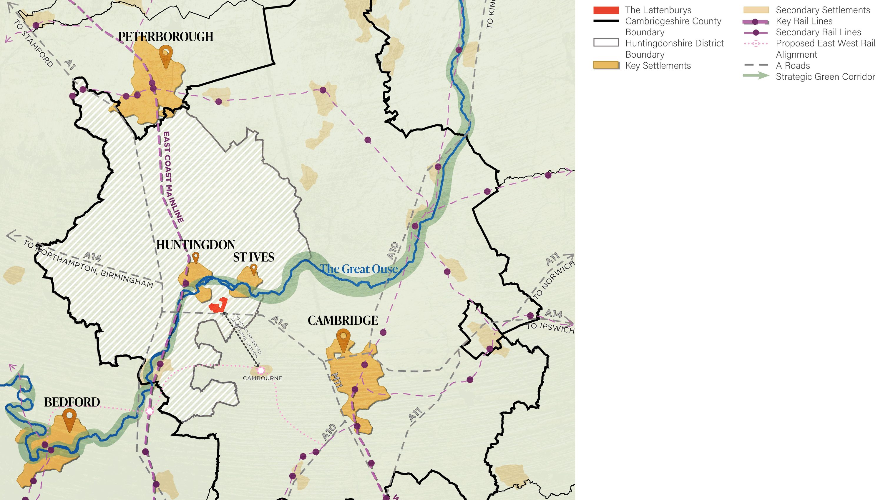
The Lattenburys represent a highly suitable, available, and immediately deliverable location that offers the most logical spatial choice for strategic growth in the Local Plan.

The logical choice for strategic growth
- Positioned within the Oxford–Cambridge Arc, the site plays a vital role in the wider Cambridgeshire economy;
- By capitalising on the legacy of the A14 upgrade, it delivers crucial housing to support the county’s high-growth clusters while directly relieving pressure on the Cambridge housing market;
- Entirely in Flood Zone 1 and free from the environmental and heritage constraints that limit alternative options across the county;
- The descending land form is highly advantageous providing a natural topography that allows new development to be integrated sensitively and discreetly within the wider landscape setting;
- Under single promotion with unanimous landowner support, the site guarantees exceptional delivery certainty without relying on complex, costly strategic infrastructure;
- The two new self-sustaining villages can reliably meet both local and county-wide growth needs from the outset of the plan period.
 (opens the full-size image in a new tab)
Well connected, and free of flood risk
- Zone 1
- The whole site lies in Flood Zone 1
- <5km
- From Huntingdon railway station, with direct rail to London
- 10 mins
- By bus to Huntingdon's facilities and train station
- 3 roads
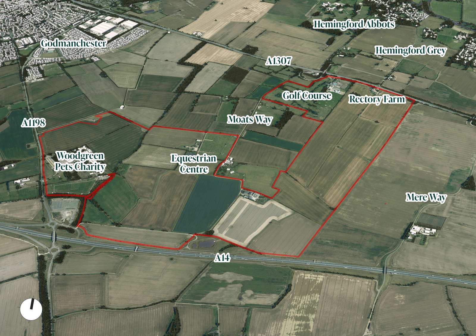
- Enclosed by the A14, A1198 and A1307
A vital bridge
Strategically, The Lattenburys acts as a vital bridge between the local needs of Huntingdonshire and the wider Cambridgeshire economy.
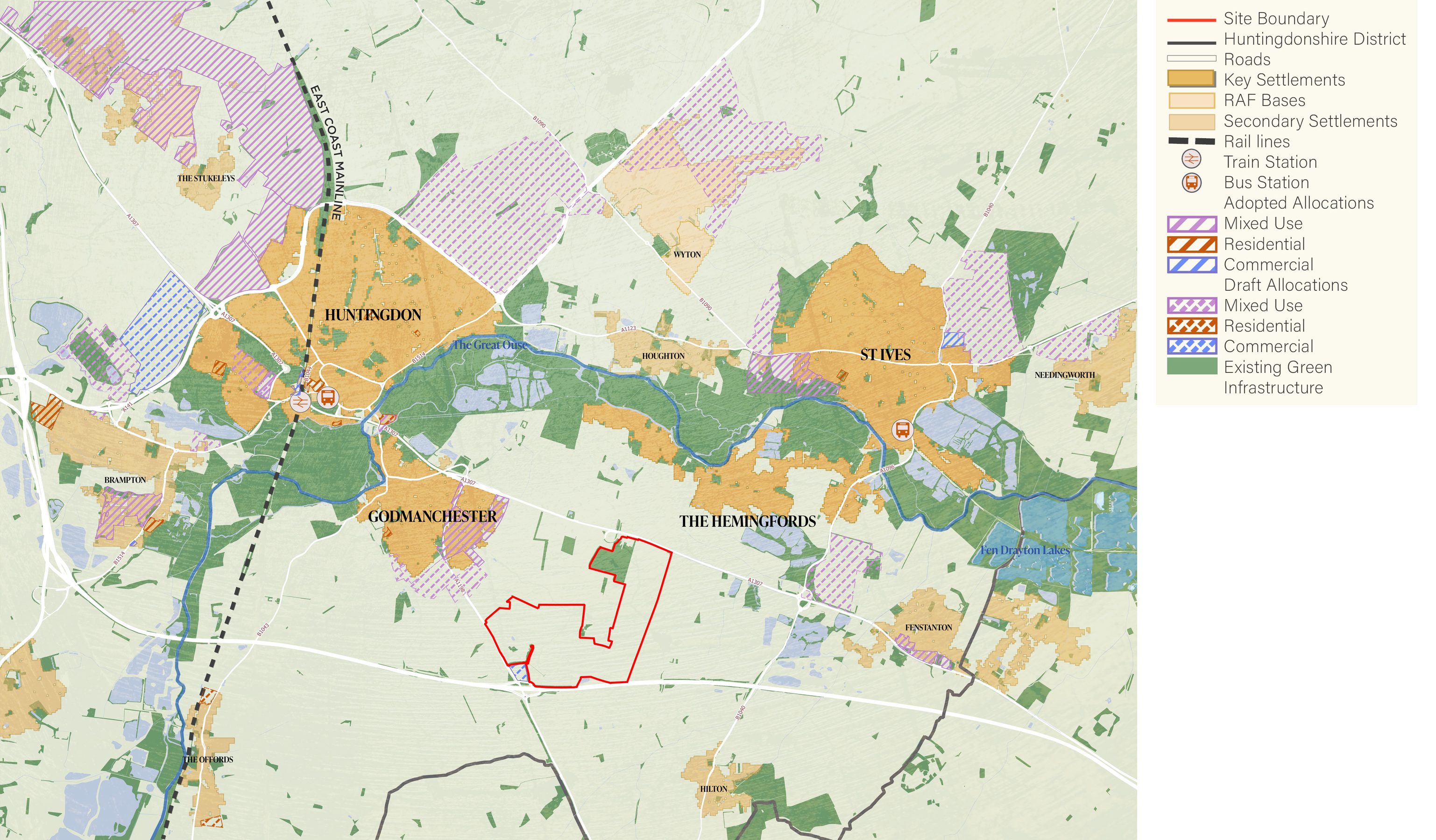
- Locally, the site supports the vitality of Huntingdon, St Ives, and Godmanchester by concentrating growth in a highly sustainable location rather than dispersing it into sensitive rural villages;
- Regionally, it provides high-quality housing to support the county’s high-growth employment clusters, helping to relieve pressure on the Cambridge housing market;
- Enclosed by the A14, A1198, and A1307, the site sits at a major infrastructure crossroads, enjoying rapid road access to major employment hubs in Cambridge, Peterborough, and Alconbury Weald;
- Being located less than 5km from Huntingdon railway station ensures fast, direct rail connections to London and the wider region, integrating the site perfectly into Cambridgeshire’s strategic transport network.
 (opens the full-size image in a new tab)
 (opens the full-size image in a new tab)
Find out more
For more information or for expressions of interest on any element of the proposed development, please get in touch.